When we started asking for questions from our listeners about the state, we got pages and pages of submissions online; so many we couldn’t answer them all.
So I combed through and picked one that sounded interesting to me. And that’s how I ended up calling a woman named Jen, and asking one of the stupidest questions I’ve ever asked.
To hear all the fancy sound effects I added to this story, listen to the radio version right here:
"Jen, how do I say your last name so I don’t mess it up?"
"Smith… it’s the easiest name ever."
Once that was out of the way, Jen told me what she wanted me to investigate: "What is the geologic history of the Wapack Range?"
What's the Wapack Range?
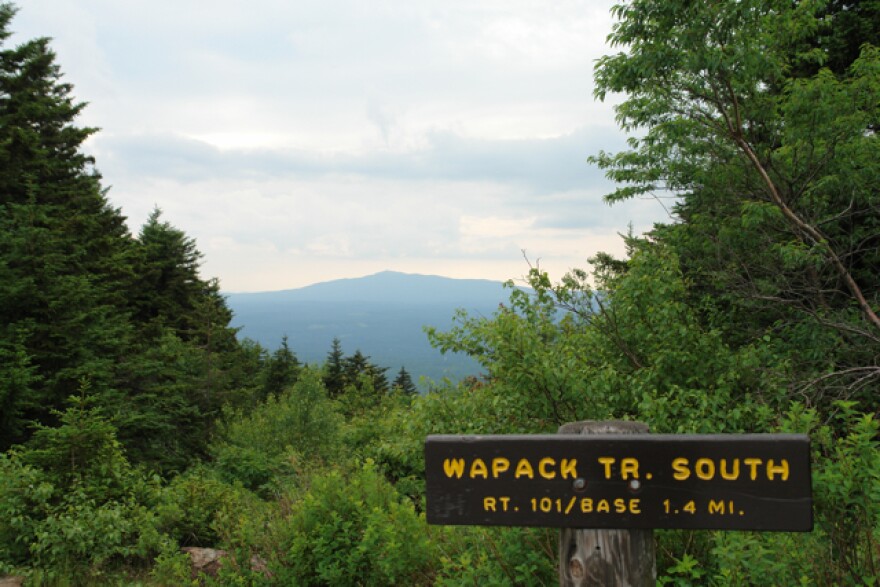
The Wapack Range runs North to South, a 20-mile stretch that crosses several peaks into the Massachusetts Border - Pack Monadnock, Temple, Kidder, Pratt, a few others. They’re not big mountains, but Jen says it’s a great hike.

"You’re halfway between Keene and Manchester and you feel like that when you get up on these ridges you should be looking at man-made things and you’re not. It’s really like an old worn trail, unbelievably beautiful - you can tell I would strongly recommend it."
I’ve gotten to be a pretty avid hiker these past few years, and honestly, I picked this question because I thought it would be an excuse to get out of the office.
I could interview some folks on the trail, maybe even write off the mileage!
But first I had to answer Jen’s question, So I called this guy named Peter Thompson.
"Well I am a geologist, I have been most of my life."
Peter studied the geology of Mt. Monadnock for his PhD, and has mapped a lot of bedrock in Vermont and New Hampshire over the years. He told me that the Wapack Range is the product of a series of thrust faults.
Thrust faults happen when one section of crust slips underneath another, which creates a sort of ridge.
"So there’s this stacking of material. However, all of these rocks were formed in the Silurian and Nevonian times as sediments in the ocean basin that was being consumed."
Geology is boring. OR IS IT?
My five year old has rock collection that he likes to show off when people come over the house. It’s genuinely one of the more interesting features of our apartment.
He’s got a couple pieces of Icelandic lava. Some sizable quartz crystals, a huge chunk of local mica, an elk’s tooth and some other random stuff. People love looking at his rocks. But speaking with Peter, I started to realize that the history of those rocks isn’t nearly as interesting as the rocks themselves - at least, when you're like me and have no idea what questions to ask.
Peter seemed used to that.
"When I was mapping on Monadnock, hikers would ask me about the geology, " Peter said. "They would ask me, 'How old is Monadnock?' And I’d always point out that my answer would be different depending on whether they were talking about, when the sediments were deposited…or when they turned to rock? Or do you mean the shape of the mountain as we see it today? It’s an important distinction when you’re thinking about how old something is."
"Were they disappointed that you couldn’t provide a simple answer?"
"Yeah, but I’m a teacher so, the role of teaching is to get people to think a little deeper."
I talked with Peter for forty minutes, and I asked a lot more stupid questions. And afterward, I knew just two things: the Wapack Range has something to do with thrust faults, and geology is complicated.
And secretly, I thought, "Geology is boring." Like, too boring for radio.
Over the next few weeks I spent time looking at the Wikipedia page for thrust faults, and other geological phenomenon. It all read like Latin to me. I was ready to scrap the story. But before I did, I decided to visit Rick Chormann, New Hampshire’s State Geologist.
Middle Earth for laymen
"The thing I think that’s the hardest to bridge is in thinking about the Earth is the dimension of time."
Rick agreed that geology doesn’t always translate well for the layman. There’s the time factor, but the field is also rife with off-putting vocabulary.
Places with names like Gandaria, and Avalon, it sounds like something from Middle Earth – not to mention Meguma!
At this point, I started to wonder - how much does Jen Smith actually care about geology? Is she just looking for a one sentence answer? Maybe it was time to go simpler.
"So maybe if we just lay out some different forces that have created the topography of New Hampshire… does that make sense?"
I didn't want to tell the state's lead geologist that what he was telling me wasn't going to make for great radio.
But, I did learn something. And I figured out a way to make it a little more dynamic - scientifically inappropriate action movie sound effects.
(Note: If you want to *hear* the sound effects, you should probably listen to the audio version of this story, posted near the top of the page.)
Check out this cool geological map provided by the NH DES:
Force #1: Plate collision
This is the classic Tectonic plate scenario: You have compression, and masses of crust being forced together – and when you squeeze something together, something has to give.
When Plates come together they crunch the surface upward. This is what created parts of the Appalachian Mountains some 480 millions of years ago, when the continents came together to form Pangea. But that plate crunching also forces crust down into the bowels of the Earth, where things are very, very hot. Which gets us to Force #2.
Force #2: Volcanic activity
Forcing crust downwards creates molten rock, and so volcanoes can pop up along the margins of those colliding plates. And some of New Hampshire’s topography is volcanic in origin - the volcanic ring at Pawtuckaway, and the Ossipee Range for example. But volcanic activity doesn’t just happen when plates come together - it also happens when plates rift apart.
Force #3: Rifting again
After Pangea came together, it split apart again, and that rifting allowed magma to find its way up toward the surface. In our case, this happened some 220 million years ago.
What’s weird about volcanic activity, is that a lot of magma never makes its way to the surface. It just pools in giant underground deposits, and those underground deposits are more likely to be what you see on the surface as mountains today.
Which gets us to Force #4: Erosion
We think of a mountain as something that is built up, but in reality, it can be something that was left over after everything else has been worn away. Erosion reveals hard-resistant rock buried under the landscape, rock that over millions of years becomes a high point in the landscape.
Force number #5: The glaciers
The latest reshaping of everything was the Laurentide ice sheet - which as Peter Thompson, was just the final bit of sculpting, like icing on the cake. It didn't so much make our mountains so much as give them their final shape.
The forces awaken...or something
All of New Hampshire’s topography was shaped by a combination of these forces over a period of millions of years. Sections of the White Mountains were built during the collision, while other bits of rock were formed when the plates rifted apart.
Some mountains, like Monadnock, were deposits of underground magma that weren’t revealed until the rest of the landscape around the mountain eroded away. And then later, the glaciers sculpted parts of our topography into what it looks like today.
The Wapack Range is all part of that history.
So back to Jen...
After I met with Rick, I felt pretty confident that I had a grade-school understanding of New Hampshire geology, but I wasn’t sure what level of detail Jen was looking for. Maybe I could just tell her the answer is kind of complicated and leave it at that.
But when I called her, I discovered she has a degree in geography. She was looking for the real answer. So I just kind of went for it.
And she totally got it...way better than I did.
"Actually, I think that’s a pretty good description. What it sounds like is there was a fault… you end up a ridge… and that process of why those peaks are there, and so maybe there was erosion around those peaks, that there was more erosion around those peaks - they were a more resistant rock?"
Now all I have to do is go see the range for myself. Too bad the story is already finished, because that means I’ll have to pay for my own gas.
Do you have a question about something in your community? Submit it here and we could feature you in an upcoming story.


