Every other Friday on Morning Edition, the Outside/In team answers a question from a listener about the natural world.
This week, Danielle in Topsham, Maine asked, “How does surveying work, with the ‘looking through thing’ and the tall stick?”
Submit your question about the natural world to the Outside/In team. You can record it as a voice memo on your smartphone and send it to outsidein@nhpr.org or leave a voicemail on our hotline, 1-844-GO-OTTER. We also accept questions sent to Twitter or Instagram. We’re @OutsideInRadio in both places.
If you’re planning to build a fence, or you’re selling your house, you might need to figure out the precise location of your property line. In cases like those, you’ll likely call a land surveyor to help determine how the lines on a paper deed actually translate to the real world.
Land surveyors usually employ a few standard tools, including the “looking through thing” and the “tall stick” Danielle referenced.
Eric Salovich, surveyor and president of the New Hampshire Land Surveyors Association, said the “looking through thing” is “an electronic distance measurer, also known as a total station.”
The "tall stick” is called a rod. On top, the rod has a piece of glass called a prism, a piece of glass designed to reflect light in particular ways.
“It's pretty fascinating to look into because no matter what angle you look at, your eye stays in the center of it,” said Salovitch.
When land surveyors take measurements, they use their electronic distance measurer, or “EDM,” to cast a laser beam towards the rod. The prism reflects the laser back to the EDM, which records the time it took for the laser to travel there and back again.
That data can be used to calculate the distance between the two points. With each reading, land surveyors can collect a lot of information.
“Every measurement is two or three lines of data: the horizontal distance, the horizontal angle, the vertical distance, the vertical angle, the slope distance,” said Salovich.
All this equipment is quite sensitive. Surveyors have to get the height and the angle of the prism just right.
“You have to put in the temperature . . . and make sure that your EDM is calibrated for the weather that it's in,” said Salovich.
By comparing these readings to known points (and doing a lot of math), surveyors are able to create accurate readings on elevation changes and the real-world location of objects on the map, like the proper placement of your fence.
“We're not only measuring horizontally to know where the house is and the property lines are, but we're also measuring vertically, so an engineer would know: where does the water flow? Where could pooling be? What's the height of the house sill to make sure that the septic tank is going to work?” said Salovich.

A 4,000-foot saga
Sometimes, surveying goes beyond fencelines and septic tanks. In fact, a group of land surveyors recently made the news for doing this kind of work on a different scale.
In the mid-1800s, a surveyor named Elihu T. Quimby used manual instruments and triangulation to calculate the heights of many of New Hampshire’s 48 mountains that stand above 4,000-feet in elevation. He counted Mount Tecumseh among them, measuring its summit at 4,003 feet.
But in 2019, when the U.S. Geological Survey flew over the mountains in a little airplane equipped with LiDAR, a new type of remote sensing technology, they measured the summit at 3,995 feet.
This measurement sent reverberations through the New England hiking community. Mount Tecumseh is on the list of New Hampshire’s famed “4,000-footers,” a true bucket list for many hikers.
Later that year, a group of land surveyors, including Salovich, volunteered to hike up to the summit with their equipment to make their own estimate.
“We ran a GPS control network around the base . . . made sure all of our equipment was jiving and accurate. And then we all hiked to the top of the mountain, determined where the summit was, which was its own exercise,” said Salovich.
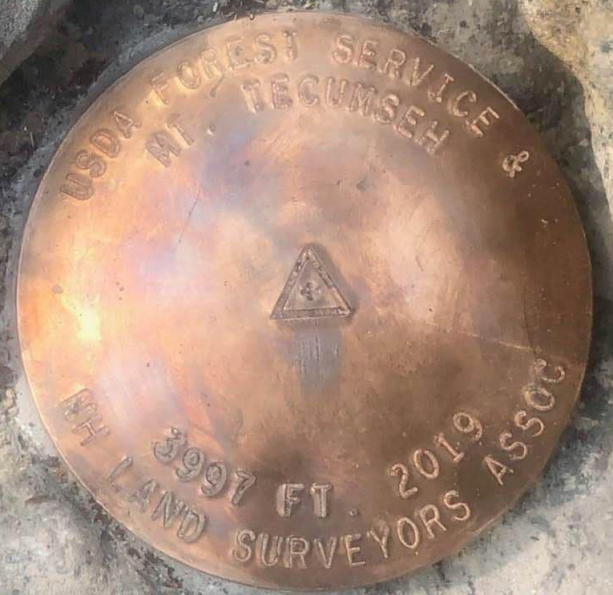
In the end, their measurement of Mt. Tecumseh’s elevation landed at 3,997 feet, right in between the estimates created by Quimby’s 19th century calculation and the LiDAR reading recorded by the USGS.
“We actually got to set a brass disk,” said Salovich. “It's one of my biggest accomplishments, to be a part of a project to monument a 4,000-foot mountain.”
Or, nearly.
Outside/In is a podcast.Listen on the platform of your choice.


