Many coastal communities were impacted by several major storms during the winter of 2024. That’s put a spotlight on a major question facing the state: just how vulnerable is Maine’s coast to a warming world, and what steps do we need to take to prepare? That’s what we dive into in this episode of Maine Explained.
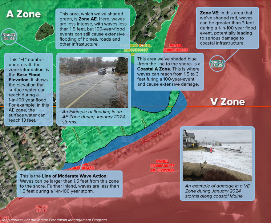
Experts say flood hazard maps are one of the best ways of assessing the risk of damage from coastal events. Here's what the labels and numbers on the maps mean, in an area of Higgins Beach in Scarborough. Here is a link to the flood maps for some of Maine.

Maine Explained is a YouTube-first video series from Maine Public that answers questions about the history, culture and the latest news in the pine tree state. Visit youtube.com/mainepublic for the latest episodes.


