Following a weekend that brought more than a foot of snow to parts of Connecticut, another storm moved into the state Tuesday bringing with it heavy rains and winds.
A partial dam break was reported Wednesday morning on the Yantic River near Norwich.
“Life threatening” flash floods are possible in the area, according to the NWS. The agency has issued a flash flood warning for the area downstream from the Fitchville Pond Dam along the Yantic River. Residents are advised to avoid the area.
A flood warning is in place for parts of Hartford, Fairfield, Litchfield, New Haven, New London, Tolland and Windham counties. Coastal flood warnings are in effect for southern Middlesex and southern New London counties.
As of Wednesday morning, about 2,300 Eversource customers in Connecticut were without power, the agency said. United Illuminating was reporting just a few outages.
Several schools across the state were delaying the start of classes due to the weather.
Check CTroads.org for up-to-date closure and detour notices, as well as to check for travel advisories from public transit agencies before leaving to catch a train or bus.
Flooding a concern
Temperatures are expected to reach into the low 50s across the state on Tuesday and Wednesday, contributing to snowmelt and the possibility of flooding.
“We do have a flood watch in effect for all of Connecticut for a timeframe that’s basically Tuesday evening through Wednesday afternoon,” NWS meteorologist Alan Dunham said. “Especially in poor drainage areas and urban areas where the storm drains are covered with snow and ice, expect a fairly good impact from that, especially the Wednesday morning commute.”
Connecticut Public meteorologist Garett Argianas said Connecticut can expect “pretty intense” periods of rain Tuesday into Wednesday.

“It's still a bit too early to tell exactly which areas will see the heaviest rain, but the overall rain forecast is about an inch and a half to four inches,” Argianas said.
Argianas said heavy winds could cause power outages.
“It's a really good idea to make sure that you have all your devices charged up during the day tomorrow,” Argianas said. “And also with the heavy rain, check your sump pump, because basement flooding is likely.”
Utilities cite storm preparations
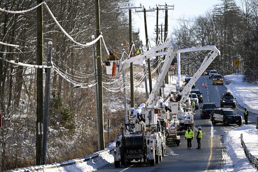
Eversource Connecticut said Monday that more than 1,000 crews would be available around the state to deal with potential downed power lines and outages, with some workers coming in from Pennsylvania and New York.
“With the melting snow from the weekend snowstorm and the heavy rains we’re expecting with this next storm, the ground will be heavily saturated, and that combined with the forecasted strong winds can bring down trees and limbs onto power lines and equipment, causing outages,” Eversource Connecticut Electric President Steve Sullivan said.
Sullivan told reporters the storm could be as impactful as a storm on Dec. 18, which left hundreds of thousands of Connecticut residents without power.
“Forecast very, very similar,” Sullivan said. “We had just under 200,000 customers out and it was a multi-day response. And we are anticipating that this is the type of event where we will have thousands of trouble spots and it will be a multi-day event for us to restore.”
Connecticut Department of Transportation spokesperson Josh Morgan said the agency is closely monitoring the storm, particularly for flooding.
“Snow to rain — that’s New England,” Morgan said. “Melted snow, melted ice, and additional rain could lead to some roadway flooding … closing down on-ramps or off-ramps, resulting in maybe some lane closures or detours on state roads.”
Cities on alert
The city of Hartford is among various cities across Connecticut preparing for the storm.
City officials anticipate flooding from the rainfall as well as the snow melt. City crews have been clearing catch basins and officials recommend that property owners clear roof drains and gutters to prevent roof damage.
"Clear the grates on the street in your neighborhood," Mayor Arunan Arulampalam said. "If you can't clear them yourself, call 311, and get the city involved in it because we need to get those clear and make sure water can drain."
When snowbanks become waterlogged they can create ice dams, which prevent rainwater from getting to storm drains, Interim Public Works Director Christopher Hayes said.
City public works crews have been working to clear as many drains as possible, officials said.

Later this week
Argianas said the forecast looks dry Thursday and Friday, but another rain storm is likely over the weekend.
Connecticut Public's Matt Dwyer, Eric Aasen and Patrick Skahill contributed to this report.


