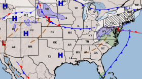
Meteorologists have been keeping an eye on a storm system that looks like it could bring a nor’easter to the area—just in time for Thanksgiving travel.
So far, it looks like the storm will dump heavy rain along the East Coast, rather than snow. That’s according to National Weather Service meteorologist Michael Kistner. He says right now, it looks like the storm will move along an inland track, bringing in a lot of warm air.
“You know, we are going to watch the track really, really closely, because any shift in that track at all further out to the east would bring in some colder air again," Kistner says. "And that would, of course, then change that precipitation to more frozen type.”
At this point, he says the storm will likely hit New York City and New Jersey the hardest, sometime Tuesday night. It would then move up to New Hampshire in the early morning hours Wednesday, and taper off in the afternoon.
If the system remains on the inland track, Kistner says we could see highs in the 50s.
The exception would be far northern Coos County, near the Canadian border. He says even if everything remains the same, that area could still see snow.


